The Remote Sensing Division is a multidisciplinary team of specialists working with advanced measurement technologies and data analysis. Through our holistic approach and commitment to innovation, we provide solutions tailored to our clients’ needs, helping them to optimize operations, make strategic decisions and increase operational efficiency.
Scope of work:
• Earth observation data acquisition and analysis;
• creation of dedicated map portals;
• performing spatial analysis using AI algorithms;
• performing spectral measurements including data acquisition and analysis process;
• atmospheric sounding using meteorological balloons and aircraft;
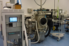
• build, integrate and calibrate advanced data acquisition systems.
Main fields of activity:
• agriculture,
• forestry,
• industry,
• defense.
Expertise in:
• IT programming, development of advanced geospatial information systems;
• advanced algorithms, integration and processing of datasets including aerial and satellite imagery;
• measurement of spectral signatures of objects, analysis of spectral curves, extraction of information on biophysical parameters of objects based on spectral data;
• advanced visualization of geospatial data with emphasis on 3D modelling and integration of point cloud, vector, raster and descriptive data;
• precise positioning with GNSS/INS and LiDAR technology.
Image data acquisition
• High-resolution aerial and satellite imagery for mapping and monitoring.
• Advanced UAV and LiDAR technologies for accurate topographical surveys.
• Innovative multispectral cameras (including SWIR) for detailed terrain analysis.
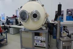
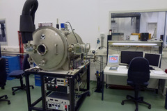
We offer comprehensive imagery acquisition solutions. We use the latest remote sensing technologies – LiDAR and multispectral cameras. Our services are perfect for R&D units and companies that require accurate and high-resolution data for their projects. We provide the data required for mapping, environmental monitoring, and spatial analysis We support every stage of the project, from planning and execution to post-construction evaluation and operational monitoring.
Examples of analyses carried out for the designated area:
• Moisture content analyses,
• Vegetation condition surveys,
• Disturbance and anomaly detection,
• Land use monitoring,
• Elevation and surface modelling (DEM, DSM).
Map Portals
• Advanced GIS and spatial analysis for comprehensive data comprehension.
• Interactive data visualization and sharing to facilitate collaboration.
• Real-time data transmission for current spatial information.
We specialize in designing and implementing advanced map portals utilizing GIS systems. These portals enable intricate multi-domain analysis and data visualization, fostering communication and collaboration among research teams by facilitating real-time data transfer across various domains. Such solutions are pivotal for decision-making in spatial planning and natural resource management. Our products ensure flexibility and complete customization.
Examples of our developments include:
• Map portals for agriculture and forestry.
• Fleet management systems for unmanned vehicles.
• Management systems for sensors deployed in specific areas.
Artificial Intelligence in Spatial Analysis
• Innovative GEOBiA and computer vision approaches for advanced image analysis.
• Real-time data classification and analysis to support operational decisions.
• Utilizing AI for pattern recognition and process automation.
We specialize in implementing artificial intelligence for spatial analysis using technologies such as GEOBiA (Geographic Object-Based Image Analysis) and computer vision. Our solutions enable full classification and analysis of data in real time, which is critical for efficient resource management and environmental monitoring. Through AI, we can automatically identify patterns and conduct advanced analysis, significantly accelerating research and development processes.
Examples of applications:
• Cyanobacteria blooms detection,
• Pathogen detection in crops,
• Species classification,
• Object structure analysis.
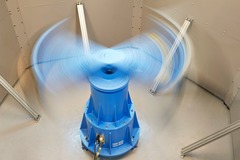
Atmospheric sounding
• Accurate sounding of the atmosphere using modern techniques and instruments.
• Utilizing weather balloons and drones to collect atmospheric data.
• Supporting climate research and environmental monitoring.
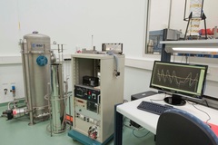
Our atmospheric sounding services utilize the latest technology, including weather balloons and drones. We provide precise data on the layers of the atmosphere. Our solutions facilitate the analysis of chemical composition, temperature, humidity, and other atmospheric parameters, supporting research on climate change and air quality. These services are suitable for R&D units engaged in environmental monitoring and the development of environmental protection strategies.